Mi6WAN Line of Site Check
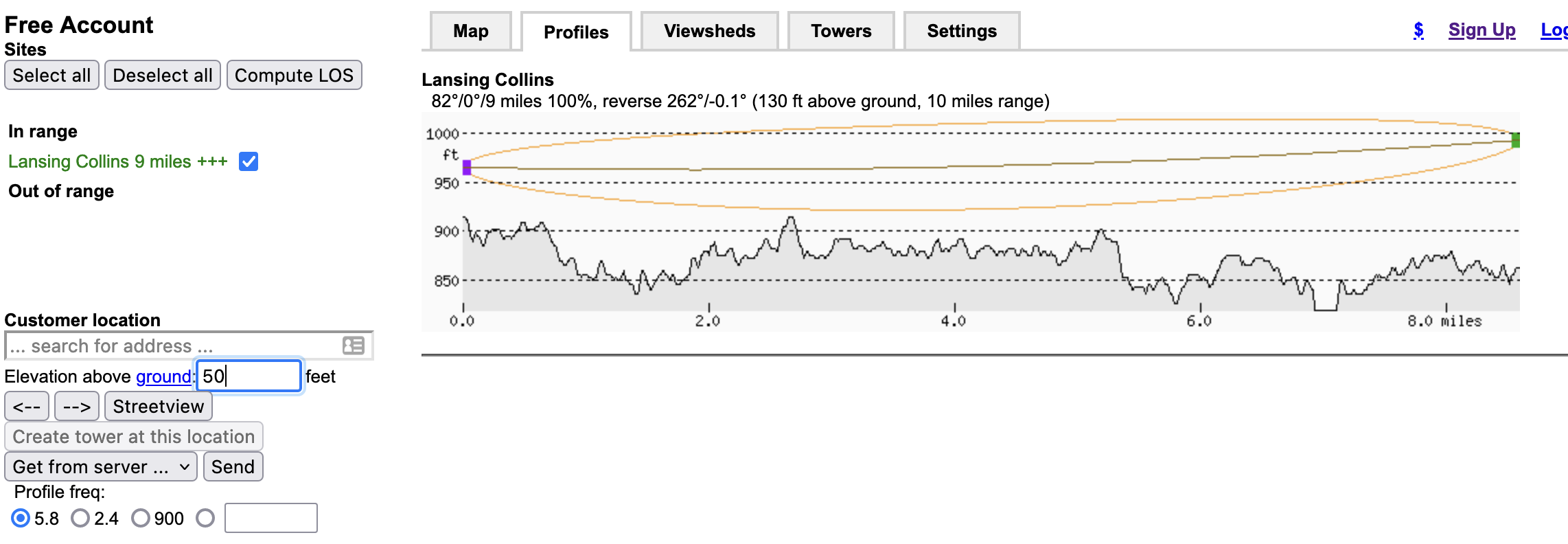
Wonder if you have Line of Site to one of our access points from a location? There is a simple site linked here that lets you import a file with the tower and run a quick path study. Once on the site click on towers and then you can import a tower file. Those files are on our PtMP Site page or the table below just click the sites name to download the file. The site only allows 5 towers per file for free but we have created a single file per tower.
After you have imported the tower drag the X to your location
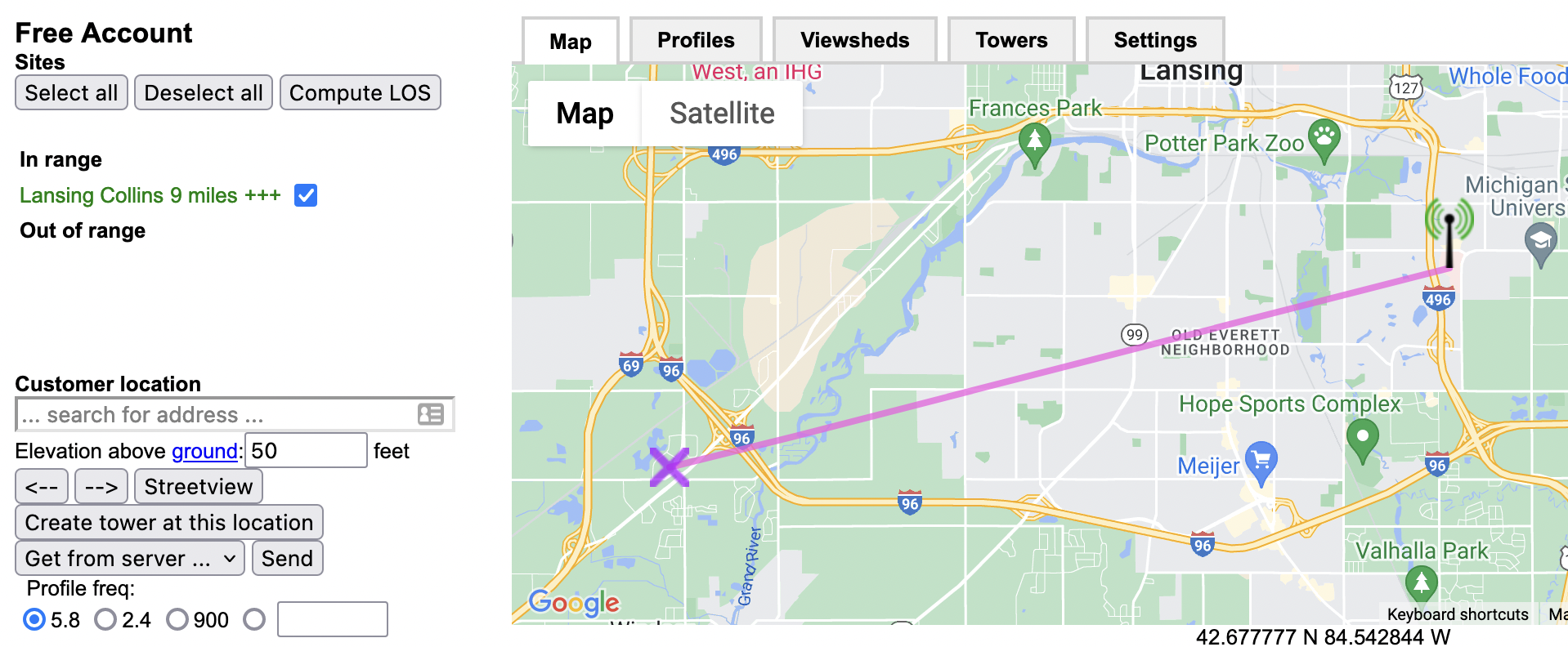
Click on the Profiles tab and increase the ground elevation to predict how height needed for LOS.
Note this does not take trees/buildings into account
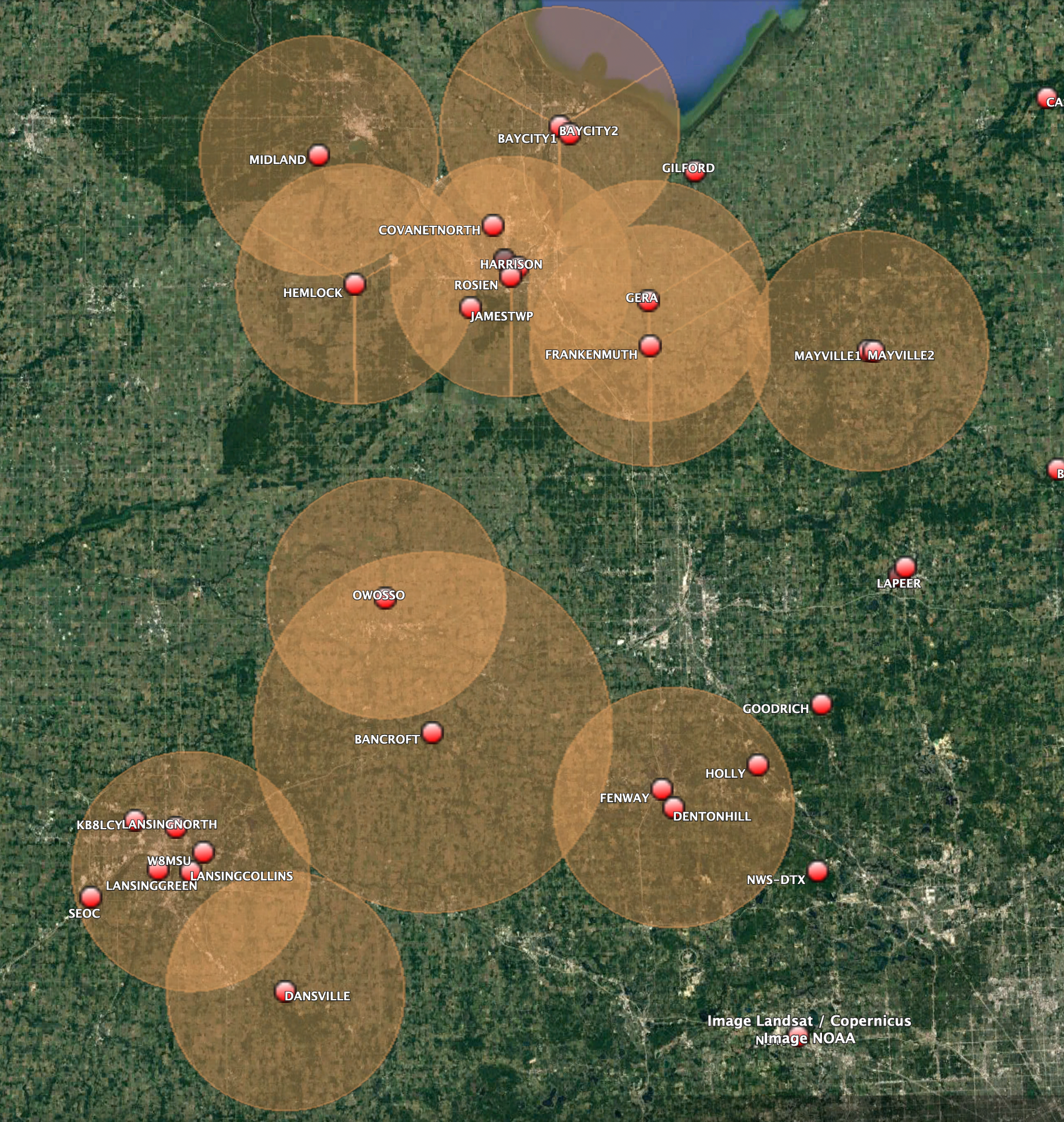
| Location | Band | Grid Square | Elevation AGL |
|---|---|---|---|
| Ann Arbor | 5Ghz | EN82DG | 180' |
| Bancroft | 2Ghz | EN72WE | 160' |
| Bay City | 2/5Ghz | EN83BO | 170' |
| Covenant North | 5Ghz | EN83AL | 120' |
| Dansville | 2Ghz | EN72TN | 150' |
| Diamondale | 5Ghz | EN72QQ | 150' |
| Fenton | 5Ghz | EN82DS | 60' |
| Frankenmuth | 5Ghz | EN83DH | 140' |
| Gera | 5Ghz | EN83DJ | 130' |
| Gilford | 5Ghz | EN83EN | 250' |
| Hemlock | 5Ghz | EN73VJ | 130' |
| Lansing Collins | 2/5Ghz | EN72RQ | 130' |
| Mayville | 2Ghz | EN83HH | 150' |
| Midland | 2/5Ghz | EN73UN | 275' |
| Pinconning | 2Ghz | EN73XV | 300' |
| Owosso | 2/5Ghz | EN73VA | 200' |
| Saginaw | 5Ghz | EN83AK | 130' |